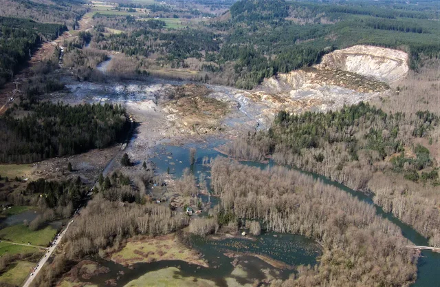
On March 22, 2014, near Oso, Washington, a riverside slope collapsed. It is not a gigantic mountain: the USGS study describes an escarpment about 180 meters high. However, the materials cross an alluvial plain about a kilometer wide and hit homes.
Slippages had already occurred in the sector, but this one travels a much greater distance. Forty-three people are dying. To understand this mobility, the researchers study the water-saturated sediments at the base of the movement and their possible liquefaction, rather than considering the debris as a simple rolling pile at the foot of the slope.
The difference between height and reach is at the heart of the story. A relatively modest slope can produce movement that exceeds the affected areas in previous episodes. Observations and measurements serve to re-examine the danger; they do not make it possible to predict for sure the time of a next slip.
What we know
Liquefaction is a studied explanation of high mobility, not a single unreservedly asserted cause.
To go to the source
- USGS — Landslide mobility and hazards: implications of the 2014 Oso disaster (new tab)↗
- USGS — One Year Later, the Oso Landslide (new tab)↗
References accessed October 11, 2026. Linked pages may be in another language.
Signaler une erreur ou apporter une précision